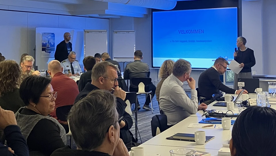
Pia Dahl Højgaard, Director General of the Danish Geodata Agency, is in Nuuk, Greenland, this week with heads of department and staff from the agency. The visit includes the annual Maritime Dialogue Meeting, which the agency took the lead in organising this year, as well as meetings with other partners in Greenland.
Maritime Dialogue Meeting 2026
On Wednesday 4 November, the Danish Geodata Agency, together with the Danish Maritime Authority, the Danish Emergency Management Agency and the Danish Meteorological Institute (DMI), held the Maritime Dialogue Meeting in Nuuk. Under the theme ‘Safety at sea in Greenland’, the annual meeting brought together maritime users, authorities, institutions and local stakeholders to discuss shared challenges and current needs. The aim was to bring together the authorities’ specialist knowledge and users’ practical experience to help strengthen maritime safety in Greenland.
The meeting was opened by Pia Dahl Højgaard, Director General of the Danish Geodata Agency. The programme featured workshops, networking opportunities and presentations from the organising authorities, as well as Joint Arctic Command and the Greenland Police. Participants had the opportunity to exchange experiences, discuss current challenges and identify areas requiring particular attention.
- “Safety at sea in Greenland is a shared responsibility. As authorities, we contribute a range of specialist knowledge and technical expertise. Local knowledge and the experience of maritime users are equally important. By bringing our knowledge and experience together, we create the best possible foundation for strengthening maritime safety in Greenland” - says Pia Dahl Højgaard, Director General of the Danish Geodata Agency.
For the Danish Geodata Agency, the meeting provided an opportunity to gain insight into how nautical charts and publications are used in practice. The agency also heard about mariners’ experiences with these products and the additional information they need to navigate safely in Greenlandic waters. These insights can supplement the agency’s ongoing work to develop and improve nautical charts and publications, which support safe navigation and also play an important role in maintaining essential supplies, emergency preparedness and a range of business activities in Greenland.
The dialogue meetings help strengthen cooperation between authorities and maritime users across Greenland and Denmark. The experience and knowledge of those who navigate these waters provides valuable input that can make a tangible difference to ongoing efforts to improve maritime safety in Greenland.
